Duration: 1h30’ one way, 2h30’ return
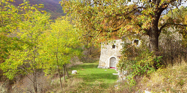
DOWNLOAD MAP DOWNLOAD GPX AND KML FILESA challenging walk of 3km with an elevation of 550 metres and an average slope of 23.3%. The path follows an ancient road connecting the village of Fontecchio to its higher pagliare, the small village to which some of the inhabitants transferred during the summer months to work the land. The village of the pagliare looks over a beautiful plateau below the Sirente mountain.
Following the ridge above this plateau towards the south-east brings you to the pagliare of Tione, the Tempra lake and the village of Goriano Valli where there is a bar/pizzeria for a stop. Alternatively, following the plateau to the right, towards the north-west, the path leads to the Altopiano delle Roche.
Nature
From the Roman bridge of Fontecchio there is a beautiful view along the river with its woods of willow and poplar forming a tunnel. With a little patience you may spot a white-throated dipper, a grey heron or a kingfisher. The path then climbs steeply between piles of stones (macerina), a sign of the ancient clearing of stones from the fields, and imposing terraces. False acacia dominates the first section of the path, but climbing further we enter coppice woods with bush-shaped trees and here we find downy oak, hornbeam and flowering ash.
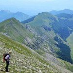
Arriving at the summit, a wide open limestone plateau opens up from which you can see the beech woods of the Sirente mountain, and now you can descend to the pagliare which overlook a plateau with a pond at the centre, rich with amphibians and aquatic fauna.
 Italiano
  English