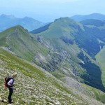
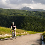
These are circular trails along various paths planned so that you need not retrace your steps to return to your starting point. Map references are given in brackets.
The Great Ripa Circle
A circular trail of about 19 km with an average gradient of 5.6%, that almost always follows easy tracks. The trail passes through the villages of Ripa di Fagnano (in the main piazza there is a drinking fountain), Opi and Bominaco; in the latter there is a bar/restaurant, a castle with a view over the ‘tratturo’ (the ancient herders’ migration trail), and the beautiful churches of Santa Maria Assunta and San Pellegrino. Throughout the trail there are beautiful panoramas of the area, and it also passes through woods, valleys, fields and small villages. The most difficult section, of about two hours, is from San Pio di Fontecchio to Bominaco. If you follow the trail from Bominaco to Ripa di Fagnano, be careful not to miss the trail as it leaves the short asphalt section and heads off to the right up a small track partly hidden by the bushes of broom.
The Great Circle of Bominaco and Peltuinum
A circular trail of about 21 km with an average gradient of 6.7% that almost always follows easy tracks. The trail passes through the villages of Opi, Bominaco (where there is a bar/restaurant, a castle with a view over the ‘tratturo’, or ancient herders’ migration trail, and the beautiful churches of Santa Maria Assunta and San Pellegrino), Tussio (with a trattoria at Settefonti) and Prata d’Ansidonia (bar, restaurant, grocers and pharmacy) and the ruins of the ancient Italo-Roman city of Peltuinum (walls, theatre and temple to Apollo), on the ‘Tratturo Magno’ (Great Trail). The most difficult section, of about two hours, is from San Pio di Fontecchio to Bominaco. About 1 km after leaving Prata d’Ansidonia, on the left, you will see the beautiful abandoned fortified village of Castel Camponeschi, just five minutes walk if you take a detour from the trail and follow the asphalt road. The 5 km section that joins Tussio (at Settefonti) and Prata d’Ansidonia passes the archeological site at Peltuinum. On this section there is no shade and it is advisable to avoid it during the hottest part of the day.
The Small Bominaco Circle
A circular trail of about 14 km with an average gradient of 7% that almost always follows easy tracks. The trail passes the villages of Opi, and Bominaco where there is a bar/restaurant, a castle with a view over ‘tratturo’ (ancient herders’ migration trail), the plain of Navelli and the beautiful church of Santa Maria Assunta and the oratory of San Pellegrino. At several points between Opi and Fontecchio there are splendid views of the Sirente mountain and the trail passes below a rocky outcrop, topped by three crosses, that hides the archaeological site of Sommovico, an Italic settlement also known as the ‘Palace of Pilate’. The most difficult section, of about two hours, is the path from San Pio di Fontecchio to Bominaco if the trail is followed in that direction.
The Circle of Santa Maria del Ponte – Bominaco, via San Erasmo – Succiano
A trail of about 20 km with an average gradient of 6.3% reaching an altitude of 1154m near the hermitage of Saint Erasmus, where there are wonderful views of the Aterno valley, and the Sirente and Gran Sasso mountains. The trail starts at Santa Maria del Ponte with its lovely collegiate church, and passes through the villages of Succiano (bar/restaurant) and Bominaco (bar/restaurant) where there is a castle with a view over the ‘tratturo’ (ancient herders’ migration trail) and the beautiful medieval churches of Santa Maria Assunta and San Pellegrino. The trail is more demanding if attempted from Santa Maria del Ponte towards Bominaco as it climbs slowly but steadily from 516m to 1154. It is easier in the other direction, but be careful of the section between Saint Erasmus and Succiano where the stony path can be slippery. The use of poles is recommended. Also be aware that between Succiano and Bominaco there is almost no shade.
The Circle of Beffi – Sant’Erasmo – Beffi
A circular trail of about 8 km with an average gradient of 5%. The trail links the village of Beffi (with its beautiful castle and church of San Michele) with the hermitage of Saint Erasmus, passing through the village of Roccapreturo (where there is a bar, a small shop and a beautiful tower perched on the rocks). The section that climbs to the little church is the most challenging (the stony path is slippery in some places) but the grand panorama is very impressive. In the countryside shortly before Saint Erasmus, there are little stone huts, or ‘tholos’, once used by farmers and shepherds. At the hermitage of Saint Erasmus you can leave the trail and follow a path that leads to Bominaco (on the right). From Saint Erasmus the trail descends to Succiano (on the last section be careful of the slippery shingle) and from here the trail rejoins the small road along valley floor and then goes left (south east) along the ‘Path of Celestine V’, following the banks of the river Aterno to return to the castle at Beffi.
The Circle of Acciano
A circular trail of about 14 km with an average gradient of 9%, it links Acciano with Roccapreturo via the northern slope of the ‘defensa’ (an area where cutting wood is prohibited so that trees may grow to provide shade for grazing animals) and the small church of Santa Maria della Valle. The return is via the valley, along an old asphalt road. Climbing from Acciano we use a series of field tracks, some with asphalt, until we join the road to San Benedetto in Perillis. We follow this road for about 500m to a sharp bend to the right where we leave it to descend into the valley on the left. Crossing this valley is the most difficult part of the trail due to the dense vegetation that can cover the signposts, and the slippery ground. Continuing towards Santa Maria della Valle, after about 3 km there is a small lake where you might see animals coming to drink. Immediately beyond, we enter a wooded area, maybe once part of an ancient ‘defensa’, where we keep to the left. We descend from the road that goes on to the pretty church of Santa Maria and continue to Roccapreturo to then leave the village in the direction of Sulmona, joining the provincial road 261. We cross this and continue parallel to it, to the left, on a little used, unsurfaced road, to Acciano.
Circle of Castello
A circular trail of about 10 km with an average gradient of 7.4%, it connects the villages of Fontecchio (bar, restaurant, post office, pharmacy, minimarket and station), Frascara, Castello (restaurant and lovely view of the valley from the lookout point by the tower), Vallecupa (pharmacy and post office) and Campana (drinking fountain in the piazza). A pleasant walk, easily achievable in about three hours, with no challenging ascents or descents. The return along the valley floor is particularly lovely with its great woods and for the traces of rural culture: dry stone walls, terraces, ‘macerine’ (heaps of stones cleared from the fields), mills and ancient bridges.
The Circle of Stiffe – Campana – Stiffe
A short circular trail of about 5 km with an average gradient of 5.5%, it joins the village of Stiffe (with caves, wine bar, bar, restaurants) with that of Campana (drinking fountain in the piazza). Not challenging but very impressive, in particular the section that follows the ‘Fossa di Campana’ (a huge karst sinkhole with vertical walls); a little further on than the ‘fossa’, towards Campana, there is a detour on the right that goes first to the villages of Fontavignone and Terranera, and then to the ‘pagliare’ of Fagnano. Passing Campana, just before the Roman bridge, turn left to take a level dirt track that follows the river Aterno.
The Circle of Campana – ‘Pagliare’ – Campana
A circular trail of about 15 km with an average gradient of 10.7% connecting the village of Campana with the ‘pagliare’ of Fagnano, going on to the ‘pagliare’ of Fontecchio, finally returning to the valley by the Roman bridge of Fontecchio and then, along the valley floor, to Campana. From the small village of Campana the path climbs steadily, but not too steeply, to the ‘pagliare’ of Fagnano reaching an altitude of 1122m. There is no water source on this trail so it is important to carry water with you. Just beyond the ‘pagliare’ of Fagnano, you will find the track that to the left leads to the ‘pagliare’ of Fontecchio and to the right leads to Terranera. We turn to the left and follow the track until we reach a little road on the right that leads to the ‘pagliare’ of Fontecchio. The ‘pagliare’ are the ancient peasant settlements where until a few years ago the inhabitiants of the valley came up in the summer to farm the mountain plateaus, bring their animals to graze and collect wood for the winter. A little further on than this last turning you will find, on the left, the path that leads to the cross (beautiful panorama!) and from here the trail descends to the valley, briefly joining a track to the left and then through a low tunnel beneath the railway line. Then turn to the right and cross the Roman bridge of Fontecchio, beyond which we find the track on the left that leads back to Campana.
‘Pagliare’ of Fontecchio – Terranera
A trail of about 7 km with an average gradient of 2.2% that joins the village of Terranera (bar, shop) with the ‘pagliare’ of Fontecchio via an easily passable track. The low gradient makes this a trail accessible to everyone, and the trees offer cool and shade even in the hottest months. Near the ‘pagliare’ there are three other paths, the first on the left leads to the village of Fontecchio (bar, restaurant, post office, pharmacy, minimarket), whilst crossing the the ‘pagliare’ and descending to the plateau below we find a path to the ‘pagliare’ of Tione and a more challenging one that leads back to the ‘piana delle roche’ and Rocca di Mezzo.
The Circle of Rocca di Mezzo and the ‘pagliare’
The ‘pagliare’ are small mountain villages used until recent years, in the summer months, by the inhabitants of the Aterno valley to cultivate the plateau, to gather wood and hay, and for their grazing animals. From the ‘pagliare’ of Fontecchio descend to the plateau below on the track that heads towards the little lake to the south. A little before arriving at the lake, take a track to the right that leads across the plateau towards the west. The path leads into a wooded valley to the west and leaves the basin ascending slightly. This is a trail of 7.5 km with an average gradient of 9.7% that arrives at Rocca di Mezzo (where all main facilities can be found). In the woods the path is challenging, rising about 500m and not for beginners. The path is almost always clear and well signposted, but it does get lost for a few hundred metres in some little valleys that were once cultivated; as soon as you have passed these though, the path becomes clear once more. It is necessary to pay attention to the signs because it is easy to lose your way, and it is wise to bring a GPS. Walking this way you come out on the road between Rocca di Mezzo and Terranera. Turn to the left to enter the village. To return you must leave the village again retracing your steps until you pass the cemetery, then instead of following the asphalt road, turn left on a track that rises slightly and from here just keep going to the plateau below the ‘pagliare’ of Tione (Piano di Iano). Attention: shortly before reaching the end of this road, you must turn to the left on a track that leads you to the Piano di Iano below the ‘pagliare’ of Tione. Crossing the plateau towards the little Church of the Trinity, you arrive at a junction with the road that leads to the ‘pagliare’ of Tione. Joining this you arrive at the little Church of the Madonna di Loreto and just beyond is the small road that descends to a great open cistern for collecting rainwater, used for the herds. After the cistern turn to the right to descend to a white road that leads to the plateau below the ‘plagliare’ of Fontecchio. Attention: remember to take water as there is none to be had along the way!
The Small Circle of the ‘Pagliare’
A circular trail of 15.5 km with an average gradient of 10.6% that connects the village of Fontecchio (bar, restaurant, post office, pharmacy, minimarket and station), the ‘pagliare’ of Fontecchio, the ‘pagliare’ of Tione and Tione degli Abruzzi (bar). At Tione you will find a lovely triangular piazza and, along this section, there is an impressive square tower. There are two challenging ascents. The first between the Roman bridge and ‘pagliare’ of Fontecchio with an ascent of 500m in a little over 2 km, and an average gradient of 23.3%. The second between the village of Tione and its ‘pagliare’ (which this trail passes on the descent) with a drop of 600m in 4 km and an average gradient of 16%. Coming from Fontecchio, after the Roman bridge, with the station in front of you, turn right until you pass through the low tunnel under the railway. Then turn back to the left along the tracks for 200m until you find the beginning of the path on the right. The use of poles is recommended.
The Great Circle of the ‘Pagliare’
This path links the previous one with a longer trail and allows an easier descent with an average gradient of 6.7%. It adds 9.5 km to the previous trail of 15.5 km, the Small Circle of the ‘Pagliare’. From the ‘pagliare’ of Tione, instead of descending to Tione degli Abruzzi, proceed towards Goriano Valli. After 4 km leave the asphalt road to return to the path (19B of the Parco Sirente Velino), that in an hour will bring you to Goriano Valli (bar, drinking fountain). Passing through the village, the path comes to the ancient circular tower of Goriano, and then descends towards the railway and the Aterno river. Passing over the Roman bridge, you join the ‘Path of Celestine V’. Once you have crossed the bridge, climb to the left over a rocky promontory above the river. On top of this you will find a path on the right that climbs to Beffi Castle but, following the trail, we come first to Beffi station and the Collegiate Church of Santa Maria del Ponte returning finally to Fontecchio.


 Italiano
  English